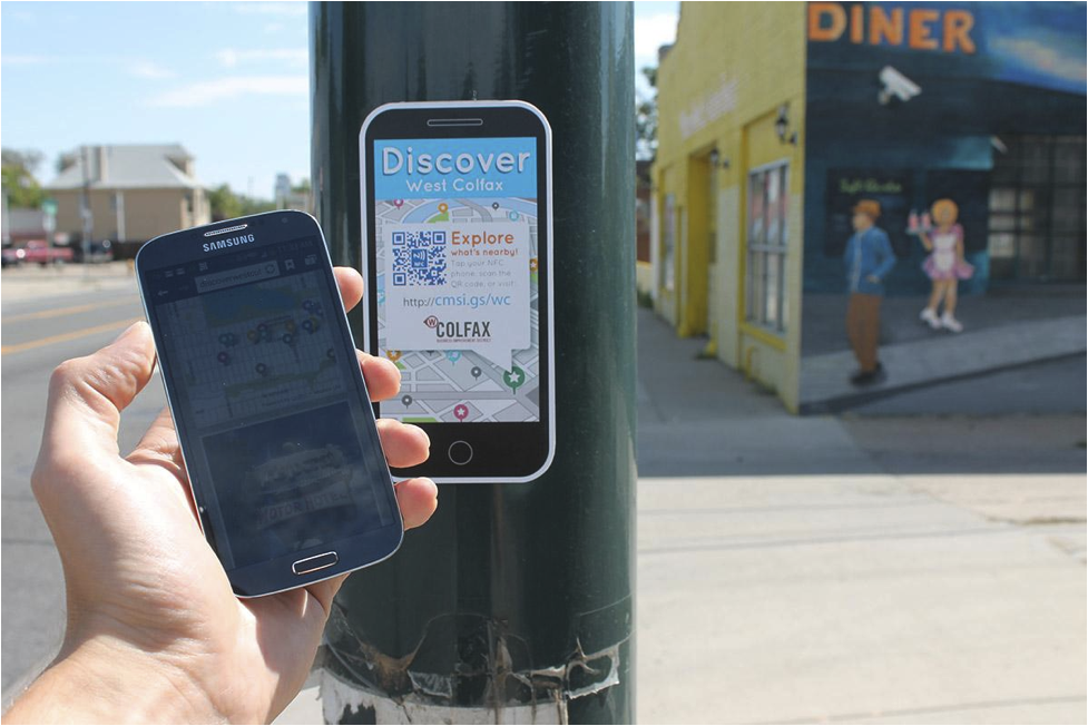
New way-finding signs are springing up in the public spaces of West Colfax (a neighborhood in Denver, Colorado). But these signs don’t just point you in the direction of actual places; they point you in the direction of your smartphone to find out more. With a simple tap of your mobile device to the sign (using NFC technology or QR codes), you will find yourself holding a dynamic guide to nearby destinations — from historic spots to public art to local businesses — in an instant. It’s a whole new way to experience the West Colfax business district, and it’s all contained in the palm of your hand.
The Business Improvement District of West Colfax is using mobile technology combined with a comprehensive neighborhood way-finding signage system to highlight the rich history of the area, encourage exploration of the community, and link the neighborhood to the new light rail (each of the stops being a destination on the new mobile app). Users are prompted by signage to pull out their smartphones and tap the sign (or type the URL for people with older smartphones) to access an intuitive, location-based guide to what’s nearby. With no download or wait time required, the mobile tool gives citizens and visitors instant access to local treasures that are within walking distance.
Dan Shah, Executive Director at West Colfax BID and project manager behind the mobile way-finding campaign, understands that reaching pedestrians on-the-go is vital to opening up the neighborhood for walkable discovery.
“We realized that most people are accustomed to using their mobile devices for many aspects of their daily lives,” says Shah. “So we decided to leverage our way-finding system by including a tool that would allow the average smartphone user to just tap-and-go. The signs combined with the mobile app are showing people what our community has to offer, in a very user-friendly and accessible way.”
The community maps are designed to inform users about the spot they’re standing in — whether it’s the historic Charles Dickinson Library, the colorful Mi Pueblo Market, or the Perry Light Rail Station — with more information about each sight available at the tap of a finger and a street view widget to keep folks oriented. From there, people can browse nearby locations or use filters to search for specific places like cafés or parks. Social media sharing is built into the app, so users can easily spread the word about their urban adventures.
And what innovative project would be complete without the valuable practice of crowdsourcing? West Colfax is seeking public input to make their community maps as useful as possible. Users are encouraged to submit their own local spots that are missing from the app, while a rating and commenting system allows the most relevant information to rise to the top.

As the population grows ever more mobile, business districts like West Colfax are focusing on tools that can meet people where they are — literally. The mobile community maps (also accessible from desktops and tablets) are based on CommonSights, an affordable way-finding solution that combines software and signage. They provide a convenient resource for citizens and visitors, while decreasing the need for cumbersome paper maps, brochureware, or finding your way to the visitors’ center. Mobile devices, while being useful for everyday social and business activities, can now serve as a pocket-size invitation to Discover West Colfax.
##
Please support Shareable! Watch the two-minute video below & donate to our crowdfunder.


