Editor’s Note:
Shareable is partnering with Tufts University on this special series hosted by professor Julian Agyeman (Co-chair of Shareable’s Board) and Cities@Tufts. Initially designed for Tufts students, faculty, and alumni, the colloquium has been opened up to the public with the support of Shareable, and The Kresge Foundation.
Cities@Tufts Lectures explores the impact of urban planning on our communities and the opportunities to design for greater equity and justice.
Celebrate the new toolkit
Limited time only! Help us celebrate version 2.0 of the Library of Things Toolkit by chipping in $100 and receive an advance print edition.
Register to participate in future Cities@Tufts events here.
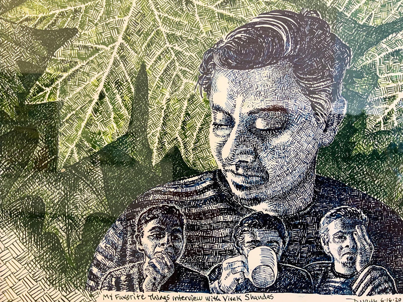
Below is the summary, audio, and video from a presentation on November 17, 2021, “Fahrenheit 911: Heat, cities, and climate literacy from the ground up” with Vivek Shandas.
In this presentation, Shandas examines the differential climate-induced impacts on urban residents, including those who have been historically marginalized from decision-making processes.
About the presenter
Vivek Shandas is a Professor of Climate Adaptation and Founding Director of the Sustaining Urban Places Research Lab (SUPR Lab) at Portland State University. Working as an interdisciplinary scholar, Professor Shandas examines the assumptions that guide decisions about the built environment and uses spatial analytical tools and policy evaluations as a means for identifying socially inequitable outcomes in the era of climate destabilization. During his spare time, Professor Shandas serves as Chair of the City of Portland’s Urban Forestry Commission, serves on several national and local advisory boards, and revels in the mountains and waters of the Pacific Northwest.
Listen to the Cities@Tufts Podcast (or on the app of your choice):

“Fahrenheit 911: Heat, cities, and climate literacy from the ground up” Transcript
Vivek Shandas: [00:00:06] We are finding that in the case of the city I live in Portland, Oregon, that the hottest areas where people who have the least formal education, limited English proficiency had high levels of racial diversity and extreme poverty. Those were characteristics of the people that lived in the hottest places in the city. So we’re talking about a temperature differential of about 15 degrees Fahrenheit from one part of the city to another.
Tom Llewellyn: [00:00:31] Could Rio’s favelas offer a sustainable housing model for cities around the world? What are the impacts of over-policing Black mobility in the U.S.? Are $16 tacos leading to gentrification and the emotional, cultural, economic, and physical displacement it produces? These are just a few of the questions we’ll be exploring on this season of Cities@Tufts Lectures, a weekly free event series and podcast where we explore the impact of urban planning on our communities and the opportunities to design for greater equity and justice.
[00:01:01] I’m your host, Tom Llewellyn. In addition to this audio, you can watch the video and read the full transcript of this lecture and discussion on shareable.net. And while you’re there, get caught up on all of our past lectures. And now here’s Professor Julian Agyeman, who will welcome you to the Cities@Tufts Fall Colloquium and introduce today’s lecturer.
Julian Agyeman: [00:01:33] Welcome to the Cities@Tufts colloquium, along with our partners, Shareable, the Kresge Foundation, and the Barr Foundation. I’m Professor Julian Agyeman together with my research assistants Perri Sheinbaum and Caitlin McLennan, we organize Cities@Tufts as a cross-disciplinary academic initiative, which recognizes Tufts as a leader in urban studies, urban planning, and sustainability issues. We’d like to acknowledge that our Tufts University Medford campus is located on colonized Wampanoag and Massachusetts traditional territory.
[00:02:06] Today, we are delighted to welcome Dr. Vivek Shandas to be our last speaker of 2021. Vivek is a professor of climate adaptation and the founding director of the Sustaining Urban Places Research Lab, which of course, is Super Lab, at Portland State University. He works as an interdisciplinary scholar, examining the assumptions that guide decisions about the built environment, and he uses spatial analytical tools and policy evaluations as a means to identify socially inequitable outcomes in the era of climate destabilization.
[00:02:43] During his spare time as a father — Vivek, I’m surprised you have spare time — but during his spare time, Professor Shandas serves as chair of the City of Portland’s Urban Forestry Commission. He serves on several national and local advisory boards and revels in the mountains and the waters of the Pacific Northwest.
[00:03:03] Today, Vivek will be speaking about differential climate-induced impacts on urban residents, including those who have been historically marginalized from decision making processes. So his talk is “Fahrenheit 91: Heat, cities and climate literacy from the ground up.” Vivek, a Zoom-tastic welcome to the Cities@Tufts colloquium. As usual, microphones off, and please send questions through the chat function. Vivek, welcome to Tufts.
Vivek Shandas: [00:03:31] Wonderful to be here, Julian. It’s an honor and a privilege to be able to speak to you from Portland, Oregon, which is an indigenous homeland and current homeland for probably more tribes than anywhere else is the historical record of North America. We have a high density of indigenous communities that currently live and have lived here for time immemorial. These include the Multnomah, the Kathlamet, the Clackamas, Tumwater, Watlala bands of the Chinook, the Tualatin Kalapuya, and many other indigenous nations that have lived alongside and live alongside the river known as Wimal, Nchi wana or the Columbia. It’s really extraordinary to be speaking to you about some of these topics that are really right at our fingertips, right under our skin, if you will.
[00:04:20] And I titled this Fahrenheit 911 for a variety of reasons, I’ll get into in a minute. But I just want to let you know that these colloquia are really important to me to participate in. I’ve done several of these, and I think they really offer a means for discussing and thinking more broadly about topics that may seem mundane or sometimes forgotten, particularly in relation to justice, equity and belonging, which is going to be a big part of our discussion today. And I’d also — thinking about these is helping us to connect with each other about how these ideas or topics that I’ll bring up today might be consistent with your experience about how cities, about how planning and about all the social engagements, interactions, policies, programs play out in some of our highly human-dominated landscapes. And then, of course, to establish a platform for us to be able to discuss further and into the future some of the points that I bring up today.
Vivek Shandas: [00:05:15] This is a work in progress. I will begin by that. You’ve already had conversations with folks, preeminent scholars in the field, talking about contested geographies, the commons, community engagement, the Global South climate action, gender and the invisible woman syndrome, natural hazards and equity, policing, green cities, urban resilience and justice. And I’m part of this long set of topics that are extraordinarily important for us to be touching on at this monumental time where we’re seeing issues of climate justice, issues of racial justice, and issues of economic justice all coming together at a time where our institutions are really trying to hold on to long-lasting power structures that have been in place.
[00:06:00] And so I expect my work, as I was saying, very much in the making. And the Fahrenheit 911 is really meant to offer an indication into the kind of work that I do. It tends to be — it’s a quantifiable number, right Fahrenheit 911, and it allows us to capture the differences among measurements of things. And so I’ve been spending a lot of my time thinking about what is it to measure things and how can measurements reveal the invisible and what is it that can help us advance? In terms of our discourse, our dialogue, our ability to make decisions that really center historically disinvested places, communities and often erased realities.
[00:06:43] So climate literacy is another operative term that I use in this title, and that’s perhaps a provocative approach to suggest that planners have a real need to develop skills around how do we enable climate literacy and climate literacy is, for me, really about identifying how an individual or community’s ability to connect their personal and collective experience with the broader climate system. That ability is becoming far more important for us, as I’ll argue today, to reconcile so that we can advance planning actions as well as city management in a way that is inclusive of communities that are hardest hit. As often the moniker goes, hit first and worst by a lot of climate-induced disasters.
[00:07:32] And finally, from the ground up Fahrenheit “911: Heat, cities, climate literacy from the ground up,” because none of this work that I mention is really done without the community at the center of it. The people that are affected, being expansive, inclusive, equitable in our engagement processes is really at the core of the work that I’m hoping to talk with you and discuss with you today. So I’ll talk for about — in terms of format, I’ll talk for about 30 minutes. This is a work in progress. I welcome your feedback. I’m going to go ahead and share my screen now and provide you with some visuals that may help in grounding this work in this particular moment.
[00:08:16] I’ve talked a little bit about my background. I grew up here in the South Indian city of Bangalore for the first 10 years of my life, and I was constantly amazed by the interaction of people with a lot of ecology that was very present in our cities. I grew up coming home from school, for example, where my mother would be up against a kitchen wall as monkeys rifled through the kitchen cabinet, pulling out things and tossing it around and trying to chase the monkeys away with my school books and pots and pans I could grab — was really some of my earliest memories of interacting in a urban ecological system.
[00:08:56] Which then, as my parents immigrated to the Northern California town of Santa Rosa, I quickly had to reconcile these landscape and ecological differences that I would see around me, where landscapes were very prescribed and delineated into very specific sections where people could walk, where people in wheelchairs could roll, where cars needed to be parked, where trees had to be planted. It was very prescribed and it was very different from the kind of organic functional anarchy that often made up the city landscape that I had to traverse on my way to school each morning and back. And so part of my area of focus is really thinking about the notions of social change, adaptive management, community resilience and trying to think about grounding that within policy structures that generate distributional injustices.
[00:09:48] Julian Agyeman and others have been my mentors, intellectual mentors, in this work. Many folks, like Julian, are well ahead of their time writing about many of these topics for decades, and so I’ve been trying to build on that work, largely focusing on urban areas and landscape transformation, going back to my personal story there. And thinking about what power-sharing looks like, what centers of cultural diversity could offer a means for improving dialogue about the implications of local decisions.
[00:10:18] Trees have been a big prominent factor in my work. I serve on the Urban Forestry Commission – chair the Urban Forestry Commission for the city I live in, Portland, Oregon. I serve on national urban community forestry advisory boards. And so trees really feature prominently into my work, in part because I like climbing trees. I’ve always liked climbing trees. The last tree I went up was about 273 feet, and that was quite an experience to go up that high and feel that close to another swaying present and incredibly verdant part of the landscape. So I’m fortunate again to live here in the Pacific Northwest, where we have some big ones.
[00:10:56] So to jump a little bit into the more scholarly side of my work, I am situated in this place where landscapes are constantly viewed, from satellites, from drones, from on the ground experiences. And I really draw on many different methodologies to try to understand the distribution of landscapes, what’s going on in them and what that tells us as emblematic of the priorities that we as a society imbue upon specific places in our cities. And so that’s a theme that keeps coming up when you look at a landscape, for example, like this one, where there’s an open road, there are cars parked on the side, and there’s one right next to it where you can’t even really see the road because the dense canopy cover fills in the spaces above the streets.m And so these two neighborhoods — or these two streets — are very different in the experience that people may have walking on those sidewalks.
[00:11:52] Whereas in other places, very different landscapes, right? And we can juxtapose those two, which are less than a mile apart, and we can ask ourselves, what went into the creation of this particular landscape as opposed to the prior landscape? How did the decision making processes? What were the considerations made? What were the priorities that were brought to the table when these landscapes were designated, divided and so carefully prescribed in terms of what their land uses would look like? That is an incredibly, needless to say, powerful position for city planners and for urban planners and regional planners to be involved in.
[00:12:34] And I’m likely not saying anything new with this, though, what I want to kind of put this up against is what we are up against, and that is this moment of existential transformation of our entire planetary climate system, as you have heard from other speakers in this series. This is a time where we’re seeing levels of greenhouse gases getting blanketed by the atmosphere and forcing that heating onto our planet, where we have larger amounts of that heat trapped in the atmosphere and more transpiration — evapo-transpiration occurring, more moisture in the air where greater amounts of water will fall over shorter periods of time, where more intense heat waves will hit, where we’ll have a number of these varying effects of the climate happening very locally.
[00:13:22] And so when we’re talking about a place that’s designed in a particular way, how has the climate system been brought into the design of that place? How has the infrastructure been brought into its ability to mediate or moderate the amplifying temperatures? These are the kinds of questions that I think we’re really up against here, and this again, is centered around the idea that we have a climate literacy challenge in our society, where actions are still woefully inadequate for being able to safeguard those hit first and worst in these events.
[00:13:58] I happen to be focusing on this area of urban heat, which is something that is convenient because it’s something we are measuring on our bodies since we were kids. And so it’s very accessible to be able to talk about temperature with communities. And I found that to be an avenue through which I can have conversations about the climate without ever having to bring up climate change. And that’s been really helpful for me. And I’ll intersperse little bits about how heat and climate and city infrastructure have been interacting. And what I found to be helpful and not — again happy to have facilitated discussion after these few remarks.
[00:14:39] So let me just jump into a little bit of a provocation that I’ll start and end with. Lots of words on this slide, but I just want to suggest to you that right now, if I step back from what I see, one foot in the university and one foot in advising in a consultancy, I work a lot with community-based organizations, a lot with municipal agencies. I have a real privilege into having an insight moment into workshops occurring with actual planners. And so the three areas that I keep seeing planning and climate interact is this area of scientific industrialism, which is really about smart cities, autonomous vehicles, decarbonization and a lot of technology being pushed into the climate agenda and planners coming along with that.
[00:15:21] And another side of it is also this idea of community governance. We have Lots of literature and scholarship spent on this and really thinking about institutional design, stakeholder engagement, collective coordination, lots of those kinds of challenges being addressed in this area of climate action. Then there’s a third that I would suggest is this idea of deep ecology, the idea that we’re talking about nature-based solutions, ecosystem management, environmental sustainability, all those things really being brought in as saying, these are the answers, these are the policy directions that we need to be considering when we are talking about destabilizing climate and ways in which we can enable safeguarding of our cities, our infrastructure, our communities, our ecosystems.
[00:16:05] And so these three, I would suggest, is at least general buckets that we can start thinking about the current way planning practitioners are negotiating some of these uncertainties. These have been policies and programs kind of followed, depending on which paradigm you really are holding on to or which paradigm the City Council or County Commission is holding on to. And these have been criticized from a variety of perspectives. And I don’t want to spend too much time on that, though I do want to get into the idea and suggest to you the idea of climate literacy as being an emerging paradigm that is almost a bridging paradigm that will need to have planners trained in and engaging around so that we can be better equipped to address some of the challenges our cities and their inhabitants are experiencing.
[00:16:52] Three things about this climate literacy piece is it’s about the language of climate change and how that’s reflected in policies and programs. We see reviews of climate action plans that have been done by several scholars getting at this particular piece. We would want to bring this notion of centering historically marginalized, dismissed or disinvested populations into policy processes and project specifications. And then we’d want to think about policies and programs that integrate evidence-based climate solutions. Those are three areas that I think are really going to enable communities to be more literate and to be engaging in the conversation of climate more generally, which planners can help to mediate.
[00:17:32] So with that, the thing we’ve been doing to kind of advance some of that work is to move into this area of community-based participatory climate science where we’re attempting to provide a platform for communities to go and do a joint fact-finding approach where we provide very simple instruments for communities to go and collect temperature measurements, as we’re talking about Fahrenheit 911, about measuring things, going out and actually trying to engage in what is the temperature of this place and how is that different from another place?
[00:18:09] And so this has been a very robust process. We’ve been engaging communities. We’ve engaged about 50 different cities and regions across the country. We’re doing these more internationally in 2022. And so it’s been a really — how do I put it? It’s been real. We’ve been really engaging in conversations about why some areas are different from other areas. And that conversation is, I would argue, some of the most important aspects of building a climate literacy from the ground up.
[00:18:40] And so these little measurements, these little snorkels that you see on the car go out and they collect — just don’t need to get into the mechanics, we have many papers on this — but they collect temperature, humidity and more recently, air quality measurement every one second. And we do this in the morning, afternoon and evening, collecting hundreds of thousands of measurements around a municipal region. And we end up doing some fancy math and mapping processes as the socio-spatial scientist that I claim to be. We describe what temperatures look like in the morning, what temperatures look like in the afternoon and what temperatures look like in the evening.
[00:19:17] This is what people experience. It’s not the surface temperature, it’s actually the air temperature, and we see that that varies quite a bit from neighborhood to neighborhood. And it wasn’t until we actually put these maps in front of community members and said, Hey, this is what we’re seeing in your region, and community workshops, we’d immediately get into the question of why do we see these patterns and what’s going on beneath that heat? Who’s living there? And when community members asked us to dig into that a bit more, we looked at this in several cities and we are finding that, in the case of the city I live in Portland, Oregon, that the hottest areas were where people who had the least formal education, limited English proficiency, had high levels of racial diversity and extreme poverty. Those were characteristics of the people that lived in the hottest places in the city.
[00:20:07] So we’re talking about a temperature differential of about 15 degrees Fahrenheit from one part of the city to another. Which was surprising for a lot of folks because that wasn’t something they had really reckoned with. And they’re asking questions like “Wait, my neighborhood, that’s why I keep going over to my friend’s house because my house is a lot hotter than my friend’s house,” and “I’ve always known that throughout my life.” And so these realities of individual experience interacting with the climate system were starting to be revealed as we were digging into this a bit more.
[00:20:41] We went a little deeper with this and we started asking questions of why were these patterns so consistent across the entire country, where air temperatures, surface temperatures, and socio-demographics were often suggesting that historically marginalized communities were living in places that were the hottest? And so we looked to federal housing policy back from the 1930s, which many of you, if you’re working in cities, you’re probably well aware of — I don’t need to get into this in too much detail, though happy to as well — but this idea of redlining, the idea that each city was through the homeowner’s loan corporation and the Federal Housing Administration would be divided into four different grades, Grade A being “the best,” where investments would go in, where mortgages would be backed, and where communities would have a lot of wealth generation capacity.
[00:21:37] This is also a Grade B, which is considered “still desirable,” in the official language of redlining, and that was still places where mortgages were backed, where a lot of these particular areas and cities were designated. A Grade C, which was definitely declining in the language and importantly, Grade D, which is the red areas, which is where the term comes from. Red Line — where investments were essentially not provided, not given, not instituted in any way. And so what we see from that is that these four areas of cities really allow us to start thinking about how temperatures vary from one part of another. Did that policy that went from 1930s all the way to 1968, where it was removed as part of a number of civil rights actions, including the fair housing laws that came in in the mid-1960s, and yet, can that particular policy over those decades cast such a long shadow to where we can start seeing the imprint of today’s climate on those neighborhoods?
[00:22:38] So we delved into this in about 2016, 2017, and we essentially started looking at 108 cities across the country. And what we found pretty consistently in these 108 cities was that the amount of green space, that was a good indicator for us to see what was going on there, varied where the A areas, that’s the invested areas, if you will, were consistently having far more green space than their redlined counterparts. This pattern held out regardless of whether we’re talking about the Midwest, the Northeast, the West, the South.
[00:23:15] And similarly, when you look at the amount of green space there as well, the A areas tended to have, on average, more green space than impervious surface. That’s the asphalt, the concrete, the materials that make up neighborhoods that really amplify heat. And so we see that the D areas, the impervious surface that amplify heat are two to three times the amount as the amount of green space in those.
[00:23:44] And when we looked at temperatures across the region, we also were very — this landscape reflected exactly what we saw in temperatures where temperatures were much hotter in those D areas consistently. And, in fact, they were upwards of about six degrees Fahrenheit, hotter across the 108 cities than their green-lined areas. And when we looked at the landscapes themselves like, actually, what’s there, going back to my interest in negotiating landscapes, was that the amount of asphalt and pavement, clearly much higher in D graded areas, as well as C graded areas, large scale housing projects, highway projects, big box stores where more consistently present in the C and D areas, industrial facilities often were right adjacent to residential facilities in the C and D areas, as opposed to the A and B areas. And then, of course, the lack of green space that we’ve been able to quantify and other papers and scholarship that’s come since have corroborated those findings.
[00:24:46] Interestingly, the city that I live in ranked top of the list of the difference between D-graded areas and A-graded areas in terms of temperature. We found a Fahrenheit difference of almost 13 — 12.8 degrees Fahrenheit in Portland, Oregon, Denver, Minneapolis, all were ranked according to that temperature difference. And ever since this paper was published in 2020, we’ve been digging into case studies of individual cities to try to understand what was going on during that period and what is actually going on today to suggesting these differences in temperature.
[00:25:22] And so we asked the question of what’s going on today in these A, B, C and D areas? And we looked at census data just looking at population change from 1980 to 2020 — a forty-year period, well after redlining was abolished. And so what we see, and if you excuse the typo here, these are percentages on the y-axis — zero, 10 percent, 20 percent, 30 percent, and Home Owners Loan Corporation, that HOLC grade along the x-axis. And if you look at these, what we’re seeing is the population change in the C and D areas seem to be far greater regardless of the city we’re looking at.
[00:26:00] I’ve just got images here from West Coast cities, but we’ve done this across the country, whether it be Oakland, whether it be Los Angeles, whether it be Berkeley, whether it be Sacramento, whether it be Portland — we’re seeing pretty regular patterns, pretty consistent patterns that the A areas and B areas are often almost walled off to other density programs and ordinances and policies that are established in all of these cities. And yet somehow that density is ending up and in these particular C and D areas, which, as you might imagine, is squeezing out the ability to do anything else as in terms of parks, open space, street trees, etc., in many of these neighborhoods. And so not only are they starting off with more asphalt and more concrete, these can be areas they’re now being subjected to policies that amplify temperatures through greater densities with little regard to the heat and climate impacts that might befall the communities living there.
[00:27:04] This became all too real this last summer, when we had a historic heat dome come through the Pacific Northwest and the places that in 2009 I had identified through a study where we anticipated the largest number of fatalities to occur as a result of the built environment and the social demographics, those were the exact places almost down to the individual parcel where we were able to identify folks were going to die in this last historic heat wave, and we have records of upwards of almost a thousand people in the Pacific Northwest died. And in that short period, starting in early July, all the way through to mid-July, this 2021. And so this perpetual impact of climate in relation to human vulnerability is something that I think behooves urban planning agencies, city management programs to really reconsider as we’re moving into this climate age.
[00:28:03] A friend and colleague, Chris Shell, put out a paper recently that also looked at this similar relationship and on a broader more conceptual level, connecting notions of environmental justice and social justice through this series of layers. And it was uncanny how both of our thinking around this really came together at the same time. And we’ve been in conversations about how to deepen this work in the coming years, where systemic biases underlying the way we think about our neighborhoods, who has access to green space, who is segregated, what resources are allocated to certain neighborhoods, what political representation — a very timely topic — is provided to this particular neighborhood or this particular region and how that plays out in terms of what’s on the landscape, things that folks like me can measure relatively easily. And so that helps us to then get into a deeper conversation about how these systemic biases have now led to specific patterns that we can see a lot of human health and infrastructure impacts emerging from.
[00:29:09] And so let me close out here, the last couple of slides, and just saying that we’re seeing this and one of the ways I’m seeing urban planners respond to this work is saying, Hey, let’s throw a bunch of trees at it. You said there were no trees there, let’s just throw a bunch of trees at it. Though keep in mind that the neighborhoods that have been disinvested in are also places that have a lot of distrust in government-sponsored programs. And so bringing a bunch of trees through a greening urban forestry initiative into a neighborhood that has already been dumped on and dismissed and disregarded — disinvested over time — is really salt in a wound, right? And so really thinking about how advancing cooling interventions would really first even center and begin with a community-based approach is where this ground-up term that I’m using for this particular talk is oriented.
[00:30:02] And so whether it be transportation, whether it be trees, whether it be community awareness, whether it be the built environment, housing policy, etc., one of the things that keeps coming up is in what ways can climate literacy find its way into adaptation interventions? So where is the role of the planner? What is the interaction between the individual lived experience and the broader climate system that we can help in facilitating those conversations?
[00:30:26] So let me close out by just offering three provocations, the first being that the same systems that created the inequities that our work is attempting to show have not changed. We’re seeing the same patterns play out in terms of the density measurements, in terms of where trees and green spaces are found even today, as we did almost a century ago. Provocation one. Provocation two — as I was just describing, simply moving green space or simply trying to apply these cooling interventions or climate interventions more generally and to disinvested neighborhoods without active engagement can really further exacerbate these inequities.
[00:31:06] And finally, really, what our work is really trying to do is a lot more of this community-based, participatory approach where we’re trying to engage individuals and communities at the neighborhood scale and centering what their needs are in relation to some of the power-sharing questions that come up about who makes the decisions about what happens to this neighborhood and how do we create a space for that conversation that allows us to be recognizing some of the historic challenges and injustices that this neighborhood or this community has faced. And so that’s what I have for you today and I want to open it up for a conversation — I know we have a little bit of time here. And really eager to get your reaction on some of this stuff and seeing where we can go with it.
“Fahrenheit 911: Heat, cities, and climate literacy from the ground up” Discussion
Julian Agyeman: [00:31:57] Great. Well, thanks, Vivek. Fantastic presentation. And you know, when you mentioned the word heat, it really just took me back two days. You might know I’m on the Boston Mayor’s Transition Committee and we have a meeting on climate justice in the Green New Deal. And one woman from an environmental justice organization and an environmental justice neighborhood in Boston, she said exactly what you said. She said the word heat has got such currency in communities. Don’t talk about climate change, talk about heat. So, Vivek, absolutely great point.
[00:32:32] We have a question here from UEP alum and senior planner in Cambridge, John Bolduc, who says it seems like there could be a fourth quarter to Vivek’s pie chart that covers social processes. I think the work of Eric Klinenberg (Heatwave) and Daniel Aldrich on social capital relates very directly. Do you have anything you could say on that?
Vivek Shandas: [00:32:56] Oh, my goodness. Yes, there’s so much that can be said about this. I was really struck, and I want to maybe tie a couple of different comments here together in that. We’re coming out of a historic event in the Pacific Northwest, and part of what was just uncanny was the similarity to the Chicago ’95 heat wave in terms of the people who died, in terms of the places that were most impacted, in terms of the social processes of community members feeling apprehensive about being able to actually go out and find a cooler place to be.
[00:33:27] And those were the same processes twenty-six years later that played out here. And what was remarkable was over those decades, how little social learning may have happened. Arguably, I could suggest that we knew this was going to happen. The climate is very, very unstable. There are heat waves — like this heat wave broke not just records in the Pacific Northwest, it broke climate models. And so the big question is, is this a tipping point or is this something that is a real aberration and anomaly? And part of what this is encouraging is this question of social processes, like, who was impacted and why were they impacted?
[00:34:03] And the city planners that I’m talking to were largely caught flat-footed with this one. They did not know where to look. They were sending out text messages to my phone and other people’s phone, saying, click on this link to find a cooling center near you without recognition that a lot of communities may question even wanting to go to a government-sponsored cooling center during a heat wave. And so these questions that came up over and over were something that we had been talking about for a couple of decades ahead of time. And luckily, we had a lot of folks who paid attention and are still paying attention to this heat wave. But the social processes are — myriad layers of social processes in this. I couldn’t agree more.
Julian Agyeman: [00:34:46] Great thanks. We have a question here from Teva Needleman, who works for EcoDistricts in Portland. Can you speak on how this summer’s unprecedented heat wave in Portland impacted the communities you were doing research in, especially since many of our facilities aren’t equipped for that type of heat?
Vivek Shandas: [00:35:04] Yeah, I was trying to get at this at the previous comment. I mean, it really — we did little in terms of engaging, for example, multifamily residential property owners. Such an essential member of our community because those are the folks who can reach out to those living in their multifamily residential complex and check in on them sometimes 10 days, two weeks before knowledge of a heat wave arriving, saying, Do you have what you need? Can I help you with getting you to a place? Can we get the city, county public health to support your availability of cooling options? Very little was done on that.
[00:35:42] Very little was also done in terms of RV parks and trailer parks, which are also sitting on asphalt and getting just baked. The folks who died in the RV parks — it was a very classic death in terms of their respiratory system basically failing and many of them having pre-existing health conditions as well. And so the ability for being able to reach out to those critical members who can access very vulnerable communities is something we’re now all wrangling with, in terms of at least emergency management side of things, as opposed to more longer-term planning and some of the infrastructure questions that I was bringing up earlier.
Julian Agyeman: [00:36:19] Great thanks. We have a question from the Brown House Watch Group, somebody says: on the case studies that you conducted with the highest difference between D and A rated areas, her hometown, Indianapolis, was number eight on the list. Curious if you’ve investigated Indianapolis yet and what your findings were?
Vivek Shandas: [00:36:40] Well, we haven’t yet — very interesting patterns. We haven’t looked at Indianapolis specifically. We’ve looked at probably about a dozen cities at this point in a lot of detail — haven’t looked at Indianapolis. I’m waiting for somebody in Indianapolis to come out and actually conduct one of these heat campaigns with us. So I’ll hold off. We’ve done Clarksville and Richmond, Indiana, but not Indianapolis.
[00:37:04] Anyway, part of this question really, to me, comes down to, what were the local decision-making processes occurring to create this particular pattern in this place. So in Indianapolis, that pattern was likely a negotiation between local planners, consulting groups, and the Federal Home Owners Loan Corporation, all identifying where the red and green and yellow and blue, for that matter areas would be. It’s remarkable if you look closely at some of these maps. There are individual roads that are red-lined. Like, very specific, surgical level precision in a time where GIS and mapping weren’t quite what we see today. Yet there was this incredibly precise local knowledge that was drawn to be able to delineate these spaces. And so really suggests to us, like there are some very complex social processes at work and negotiations that were going on to create what we see in Indianapolis or anywhere else, for that matter.
Julian Agyeman: [00:38:02] Thanks, Vivek. We have a question from Shmuel Yerushalmi, who’s asking if in the frames of your activity and your research projects, you’re trying to offer any practical solutions to problems of drastic eats and any other climate change risks?
Vivek Shandas: [00:38:18] Oh boy, that’s part of the whole consulting wing of this work. I mean, I don’t know how else to put it, but that’s kind of where that is. There’s a lot of practical solutions, and I would love to follow up on this one because I could talk for the rest of the time on that.
Julian Agyeman: [00:38:33] No, it’s a huge question, yeah. We have a question from Jean Boucher, who says, could you talk a little bit about the power dynamics and the politics of planning? Are we just hoping to get this information out there and somehow planning will change? Yeah, how do we make change, I think is what Jean is asking.
Vivek Shandas: [00:38:53] Yeah, you know, we’re all going to come into our theories of change in different ways. I found in my own lived experience that for this work to get activated, it really requires somebody internally, locally to advance this work. Somebody who is able to recognize the severity of the issue, recognize it’s distributional inequities. Recognize that there are specific features of the landscape that are amplifying these temperatures, specific access that some communities have and don’t have that mediates those impacts. And that person or that group of people — I have had tremendous fortune, I mean, there are some of them I actually recognize on this call here, like John from Cambridge, for example — and there are folks who are really those champions who we really need to enable and support through financial and logistics and administrative support to be able to advance the engagement efforts locally to identify what are the solutions that might work best for this particular community. And that’s really where I would really like to see the conversation go.
Julian Agyeman: [00:39:58] This isn’t a question from the floor, this is my question. I’ve noticed a lot of cities are now employing heat emergency officers. Where are they embedded, Vivek? And are they just about the immediate heat problem? Or are they thinking longer term like you and I as urban planning professors about how we can make the changes permanent? Or are these heat emergency people essentially public health people?
Vivek Shandas: [00:40:26] Right. I mean, it varies by place. For example, I talked to Jane Gilbert many times, who’s considered like the first U.S. heat officer for the City of Miami and County Miami-Dade, and it’s super interesting that that’s a privately funded position from what I understand. And then there’s a publicly funded position in Phoenix, Arizona that the mayor put forward with a professor from Arizona State.
[00:40:47] And my hunch is that, in talking to a few of the folks, it’s that heat, like many other climate issues, maybe unlike flooding per say, but it falls between the cracks. It’s like we have these institutions, these organizations that have — been bureaus that have been set up, at least from the municipal point of view, that have specific agenda specific missions. And heat is just one of those things that we’ve seen. Over and over just not get much attention And so these officers often, what I’ve noticed, is play a role of bringing together these different entities in kind of a coordinated, coherent agenda that allows the region to identify what are the strategies, what are the vulnerabilities, what are the resiliency questions that are coming up in the region.
[00:41:31] And so I think they could be from public health, they could be from planning. I personally think that planning is really well situated for not only the short term work and also the longer term work in being able to bring together the multiple constituencies to be able to have that conversation of what a heat mitigation plan would look like for a region, which is something I’m really pushing for. And then the broader governance questions that officer actually brings up, like, how are they going to be held accountable? Are there going to be specific policies that are developed for new developments that are going, are there going to be specific engagements of multifamily residential property managers that are occurring? Multiple layers like that that I think these officers are going to have to figure out how to do? But a very important point for sure is we’re seeing that governance emerge.
Julian Agyeman: [00:42:17] Question from Micah. Can you speak more about your closing provocations? Specifically, two and three. Are the economic insecurities that might result from the lack of engagement campaigns referring to effects of gentrification or something else? What are you seeing in Boston as the way the incoming administration is engaging community on the solutions coming into focus?
Vivek Shandas: [00:42:41] Wow Tough one. I can definitely speak to the provocations two and three in the sense of trying to gauge the fact that we have a long history that we’re trying to reconcile right now. What I have seen is Arbor Day Foundation, urban community forestry groups, and this is really where that comment is coming from is really advancing like this — nature based solutions is really important. So let’s bring a bunch of trees into this neighborhood, and let’s start digging a bunch of holes in these spots. Let’s identify them. And it’s like boom, boom, boom, boom. They’re ready to go. There’s money flowing through urban forestry right now, and so let’s get those trees in the ground, etc.
[00:43:15] And the city and the community members that we work on, we have a Robert Wood Johnson Foundation grant to actually conduct a Community Advisory Board in collaboration with the local community based organizations. And what they seem to be saying to us over and over is like, Wait, they haven’t even asked us in front of my house what is going to happen? And yet now not only are they putting a tree in, but now I have to be responsible for taking care of that tree. That’s my responsibility. And if that tree breaks the sidewalks, I’m responsible for fixing those sidewalks as well. So suddenly the city is burdened me with a greater responsibility that I never, ever imagined would happen without consulting with me.
[00:43:55] So this interesting kind of tension that I’m observing between residents and municipal officers is something that’s playing out in terms of it often exacerbating the distrust. And even tree survivorship, and to a certain extent, the economic insecurity of municipal agencies that go in and plant a hundred trees in a neighborhood where they aren’t wanted and 50 of them die or are somehow not cared for or vandalized and killed — actively killed. And so that is something that may seem mundane, but something I think that points to a much larger phenomenon that we’ve long been entrenched in and that is doing to a community as opposed to doing with the community and co-producing some of those landscapes together.
Julian Agyeman: [00:44:41] Absolutely. One of our alums worked in Providence, Rhode Island, and local community was getting exactly what you’re saying, the tree treatment, and one member of the community said, I don’t want that species of tree. It will drip sap on my car.
Vivek Shandas: [00:44:58] Yes.
Julian Agyeman: [00:44:58] So we have intimate knowledge in communities, don’t we Vivek? So instead of just placing things, we should be working with communities on these. We have one more question from recent Meghan Tenhoff, are these communication techniques and messaging transferable to rural communities? Have you studied or who is studying these issues in rural areas? In thinking about the future of federal climate policy, the rural electorate holds significantly more power than the city electorate.
Vivek Shandas: [00:45:31] Yeah, Megan, wonderful question. I haven’t spent a lot of time, admittedly, in working with rural communities around many of these topics. The main work I’ve done is with indigenous communities in the Pacific Northwest that are in what would be called rural areas and trying to understand how traditional ecological knowledge of fire management, for example, is a different topic, which fire is also a heat related issue, it turns out. And how traditional ecological knowledge around fire management can be better incorporated into local as well as federal fire management policies. And so that is some extraordinary work — way over my pay grade and over my head. But it’s folks that are actively involved in traditional ecological knowledge as being a direct means of being able to improve the propensity intensity, and I think expansiveness of wildfires in the west these days. Super interesting work.
Julian Agyeman: [00:46:27] Vivek, we could talk to you for ages. Fantastic presentation and what Vivek didn’t mention was the New York Times actually did some really amazing graphics covering his and his colleagues’ work. So check out the graphics in The New York Times and congratulations for getting your work, the impact out there through channels like the New York Times. Vivek, go and teach can be a good professor. Let’s give a Cities@Tufts, UEP thanks and gratitude to Vivek Shandas. Vivek, thank you.
[00:47:03] This is the final colloquium of the season. In Spring we’ve got similarly great speakers. Look out for our lists, which will be coming up soon. Thank you.
Tom Llewellyn: [00:47:17] We hope you enjoyed this week’s lecture and all of the events in our fall series. As Julian mentioned, we’re going on a break and will return with a new season of open lectures in early February of 2022.
Cities@Tufts is produced by Tufts University and Shareable with support from the Kresge Foundation and the Barr Foundation.
Lectures are moderated by Professor Julian Agyeman and organized in partnership with research assistants Perri Sheinbaum and Caitlin McLennan. “Light Without Dark” by Cultivate Beats is our theme Song. Robert Raymond is our Audio Editor. Zanetta Jones manages communications and editorial, and the series is produced and hosted by me, Tom Llewellyn.
Shareable.net is an award-winning nonprofit media outlet, action network, and consultancy promoting people-powered solutions for the common good. Additional support for our work has been provided by the Shift Foundation, Platform O S, Cloud of Goods, Collabofide, and tax-deductible donations from listeners like you.
Please subscribe, leave a rating or review wherever you get your podcasts, and share it with others so this knowledge can reach people outside of our collective bubbles.
Here’s a final thought:
Vivek Shandas: [00:48:20] This perpetual impact of climate in relation to human vulnerability is something that I think behooves urban planning agencies and city management programs to really reconsider as we’re moving into this climate age.