
Below you’ll find the graphic recording (coming soon), audio, video, and transcript from “Countering Displacement through Collective Memory” presented by Andrea Roberts on February 8th, 2023.

About the presenter
Dr. Andrea Roberts is an Associate Professor of Urban and Environmental Planning and Co-Director of the School’s Center for Cultural Landscapes at the University of Virginia’s (UVA) School of Architecture. She is a scholar-activist who brings 12 years of experience in community development, nonprofit administration, and advocacy to her engaged research and public scholarship. In 2014, she founded The Texas Freedom Colonies Project, the vehicle through which she mentors and trains future planners, preservationists, scholars, and community-based researchers to challenge freedom colony invisibility, environmental injustice, and land loss through heritage conservation. Dr. Roberts is also the Consultant/Owner of Freedom Colonies Project, LLC, which provides research and DEIA services to preservation organizations. She served as a Texas State Board of Review member and a National Monument Audit Advisory Board member. Dr. Roberts holds a Ph.D. in planning from The University of Texas at Austin (2016), an M.A. in government administration from the University of Pennsylvania (2006), and a B.A. in political science from Vassar College (1996). She is currently authoring a book, Never Sell the Land, about her experiences identifying Black planning and historic preservation practices that sustain cultural resilience within freedom colonies for The University of Texas Press.
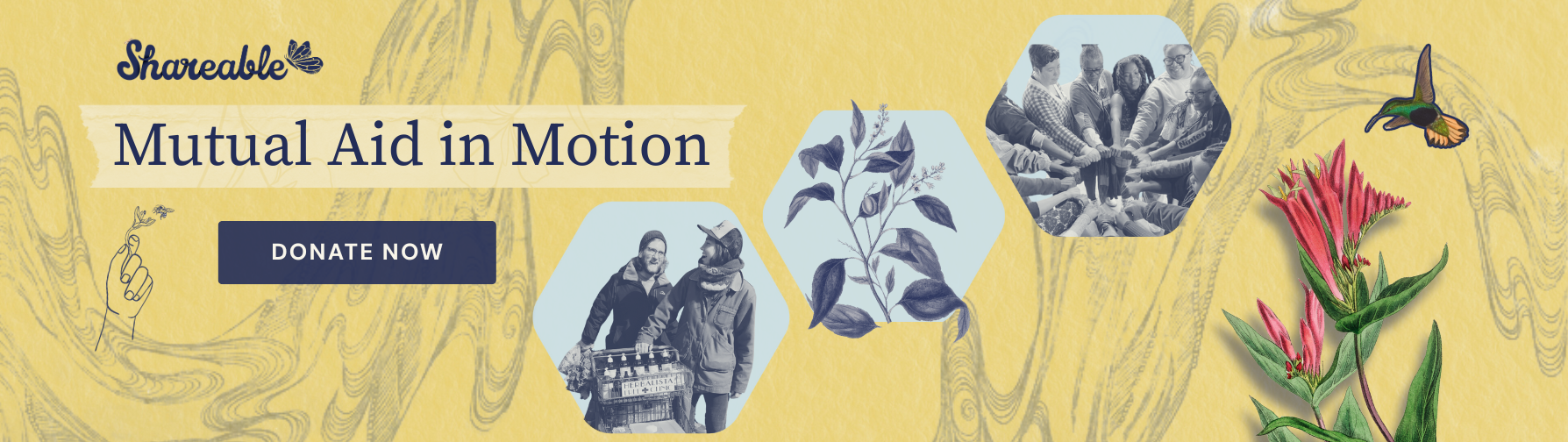
This year, we’ve seen Mutual Aid in Motion.
From scaling sharing hubs to Mutual Aid 101 trainings, we’re helping communities build the tools they need.
Every dollar fuels lasting resilience – proving that when we move together, we all move forward.
About the series
Shareable is partnering with Tufts University on this special series hosted by professor Julian Agyeman (Co-chair of Shareable’s Board) and Cities@Tufts. Initially designed for Tufts students, faculty, and alumni, the colloquium has been opened up to the public with the support of Shareable, and The Kresge Foundation.
Cities@Tufts Lectures explores the impact of urban planning on our communities and the opportunities to design for greater equity and justice.
Register to participate in future Cities@Tufts events here.
Listen to the Cities@Tufts Podcast (or on the app of your choice):

“Countering Displacement through Collective Memory” Transcript
Andrea Roberts: [00:00:06] What we see with freedom colonies — these were founded originally 1865 to 1930 — these communities began as rural clusters of landowners. And there’s a book, Texas Freedom Colonies by Sitton and Conrad and they define these places as unplanted, unincorporated, individually unified only by church and school and residents’ collective belief that a community existed. And it’s that collective belief part that really enthralled me that there is such an intangible basis for a place existing.
Tom Llewellyn: [00:00:42] How are informal and formal spaces enabling radical democracy? Can we counter displacement through collective memory? And does public space have the capacity to authentically support community restoration and emancipation? These are just a few of the questions we’re exploring this season on Cities@Tufts Lectures, a free live event and podcast series where we explore the impact of urban planning on our communities and the opportunities to design for greater equity and justice. I’m Tom Llewellyn.
[00:01:10] Today on the show, we’re featuring Andrea Roberts’s Lecture: Countering Displacement through Collective Memory. In addition to this audio version, you can watch the video, check out the graphic recording and read the full transcript on shareable.net. And while you’re there, please take some time to get caught up on all of our past lectures and our ever expanding library of stories, podcasts, how-to guides, and other resources. And now here’s Julian Agyeman, who will welcome you to the Cities@Tufts Spring Colloquium and introduce today’s lecturer.
Julian Agyeman: [00:01:55] Welcome to the Cities@Tufts Virtual Colloquium, along with our partners Shareable, the Kresge Foundation and the Barr Foundation. I’m Professor Julian Agyeman, and together with my research assistants, Caitlin McLennan and Deandra Boyle, we organize Cities@Tufts as a cross-disciplinary academic initiative, which recognizes Tufts University as a leader in urban studies, urban planning and sustainability issues. We’d like to acknowledge that Tufts University’s Medford Campus is located on colonized Wampanoag and Massachusetts traditional territory.
[00:02:28] Today, we are delighted to welcome Dr. Andrea Roberts. Dr. Roberts is an associate professor of Urban and Environmental Planning and co-director of the school’s Center for Cultural Landscapes at the University of Virginia’s School of Architecture. She’s a scholar-activist who brings 12 years of experience in community development, nonprofit administration and advocacy to her engaged research and public scholarship. In 2014, she founded the Texas Freedom Colonies Project, the vehicle through which she mentors and trains future planners, preservationists, scholars and community-based researchers to challenge freedom, colony, invisibility, environmental injustice and land loss through heritage conservation.
[00:03:14] Dr. Roberts is also the consultant-owner of Freedom Colonist Project LLC, which provides research and DIA services to preservation organizations. She served as a Texas State Board of Review member and a National Monument Audit Advisory Board member. She’s currently authoring a new book, Never Sell the Land, about her experiences identifying Black planning and historic preservation practices that sustain cultural relevance resilience within freedom colonies for University of Texas Press. And her talk today is Countering Displacement through Collective Memory: Recovering African American landscapes using the Texas Freedom Colonies Project Atlas. Andrea, a zoom-tastic welcome to the Cities@Tufts Colloquium. Over to you.
Andrea Roberts: [00:04:04] Thank you so much for having me. So as you heard, the title of my talk is Countering Displacement Through Collective Memory. And I want to begin first by talking about the context in which most of my work has been focused. When we’re talking about displacement, I’m talking about in the context of African-American settlements known as freedom colonies. They’re known by several names — Freedmen’s towns, Freedom villages, depending on what part of the country you’re in, frankly.
[00:04:35] But just to give you a context for these types of places, there’s a larger world of African-American settlement and placemaking that goes anywhere from 1738 in Florida to 1908 in California, Eatonville, Florida, Nicodemus, Kansas, and even Seneca Village, which we know is the site of Central Park and Rosewood and New Philadelphia. These are all towns, or most of them were towns and were well documented and had — they were platted.
[00:05:08] But what we see with Freedom Colonies is a little different. These were founded originally 1865 to 1930. We know that there was a delayed notification on Juneteenth, 1865 in Texas of emancipation for African Americans. These communities began as rural clusters of landowners. And there’s a book, Texas Freedom Colonies by Sitton and Conrad, and they defined these places as unplatted, unincorporated, individually unified only by church and school and residents’ collective belief that a community existed. And it’s that collective belief part that really enthralled me that there is this such an intangible basis for a place existing.
[00:05:54] But the original research list or baseline was a list of 557 place names that in any time between 1865 and 1930 were founded in Texas alone. And what remains of many of these places are just churches, schools, homesteads and cemeteries, and the reason for their decline, is generally in three categories: vulnerability, visibility, and access. And that’s born of outmigration associated with the Great Migration. And that Great Migration was precipitated by two factors — racial violence and economic opportunity — in Texas, in larger cities, and then later in California, with the growth of aerospace and jobs during World War Two or after World War Two. And then we have this general decline in population, which makes it easier to dispossess people of their properties, to have an infrastructure project that may bifurcate or unearth the cemeteries associated with these places and lead to an overall displacement.
[00:07:05] So displacement means a lot of things in different contexts. So I gave you that background because very often when we talk about Black communities, there’s a displacement from the discourse on various Black communities. We have these assumptions that we operate under, that they’re all urban, that any solutions we come up with should be one size fits all. Their aesthetics are often excluded from our sense of how we define a place or a settlement pattern that we recognize as being a valid place. We memorialize these communities and see them as something of the past, rather than having living, current stakeholders who are striving to represent that place in policymaking spaces and preservation and planning spaces. And we organize folks by census points on a map or blocks and corridors, right?
[00:07:57] We have these certain shapes or ways that we determine how African-Americans move through and take up space. And these dominate planning’s perceptions of Black space or Black places, and thereby really leading to a lot of forms of displacement, whether it be through strategic undervaluing of freedom colonies, property and the architectural style associated with them, whether they’re gentrified and overpoliced and made unaffordable for original residents — that’s a form of displacement, and displacement in place, and that’s when BIPOC in poor people’s communities are deemed unworthy of historic preservation. So it’s simply under-resourced. And there’s a traumatic cultural displacement, and the consistent sublimation of marginal groups and narratives that define place, and of course, an ongoing displacement from maps and from public history.
[00:08:53] It looks like the undermining of tenancy arrangements, barriers to legal protections when you don’t have a defined sense of place, there’s not a title, a clear title status. There’s some 75% of African-American properties throughout the United States that are held intestate. That means there were not clear wills or demarcation of ownership that was documented, and as a result, it leaves them prey to partition sales and a lot of modes of dispossession of African-American land and property.
[00:09:25] And this makes it difficult, of course, to substantiate your claim to the funding necessary to recover from natural disasters. And so what you see on this slide is a map after Hurricane Harvey, with the dark colors being the highest concentration of freedom colonies by county, the number of places and those hash marks indicating communities that were declared disaster areas by FEMA after Harvey. And you see quite the intersection. And the reason for that is in part because of the geographical location of freedom colonies, often in land that other people didn’t want. And we don’t have this romantic homestead act — there was no 40 acres and a mule. And so people settled often in land that was near bottom, what we call bottomland or flood-prone, because that’s what was available. But then we have this structural racism from that leads to an extra vulnerability to environmental calamities and injustice.
[00:10:26] It also looks like destroyed settlement patterns, ignoring the voices of diasporic stakeholders. So if you’re not living there full time or you don’t have a clear stake that can be commonly understood in the planning lexicon, your voice is not heard or it’s deemed invisible or not relevant. And it can occur on various scales, whether it be cemetery destruction or just the general ruination of independent towns and villages.
[00:10:51] So what does collective memory have to do with all of this? We have concrete spaces, we have land, we have properties, and then we have this somewhat ephemeral thing called collective memory. Collective memory is often the only place that the memory of how these places began, who the original landowners were, the original people who settled the area, and their interaction with existing indigenous folks — all of those histories, poof. Because they’re simply in the memories of elders in these communities or who originally lived here.
[00:11:24] And I began to study all this in the context of an area called Deep East Texas, which are two counties that are on the way to Louisiana. If you’re driving from Houston to Louisiana, you might very well pass through these two counties, Jasper and Newton. Jasper is more commonly associated with the James Byrd dragging death, and that dragging death actually occurred within not Jasper proper, the city Jasper, but in Huff Creek community. And so this Huff Creek Memorial Chapel is across the street from a cemetery. And that road in between is Huff Creek Road, and that’s where the dragging of James Byrd occurred. So we have quite a paradox here of a place which was an African-American settlement intentionally created and the dragging — the hate crime of James Byrd.
[00:12:18] But what I also found in these counties was a community called Shanksville, whose foundational story and the memories people had associated with the original enslaved people who founded this place was a story that catalyzed people returning, their commitments to stewarding properties, whether it be the cemetery or whether it be this spring, where it is said that two enslaved individuals, one who ran away from Mississippi to reunite with his wife, actually reunited at that spring. And so this is a place of ritual, of renewal where the descendants of Jim and Winnie Shankle will come.
[00:12:59] And we also have surrounding areas, individuals who come every year to the annual homecoming where people come home to the settlement. And they also have, these individuals you see at the table, from other freedom colonies or surrounding freedom colonies who come to announce their homecoming, because this is a point of time not simply to remember and celebrate — but what’s really important is the time that they raise money for cemetery stewardship and for scholarships for the descendants of Jim and Winnie Shankle.
[00:13:34] These are also times where people plan preservation projects such as homestead rehabilitation. It’s where they exchange stories and memories. And you also meet women called kin keepers who either write down or have in memory people’s relationships to one another, how they’re related and how that relates them to the land and the original foundations of the creation of place there. And you have people come as far away — and what really makes this diasporic and this is not theoretical as much as it’s what I witnessed — the woman in the red is coming in from Australia. And that year was the first time she’d ever been in Shanksville. And she came all the way from Australia because there were stories told to her by her grandmother when she was young about this place. And then you have an individual here on the right in the blue shirt who’s from New York City with roots in Virginia, who has some roots that he’s recently discovered in Shanksville. So it’s diaporic, truly the nature of people’s citizenship.
[00:14:41] So I observed all these different forms of oral tradition. It’s not simply oral history. That’s but one form. There were songs, there was reminiscence and memory, group accounts, testimonies, all different forms of oral traditions that had these functions: they were catalysts for bringing people back, they were proof of the resilience of the place and its meaning, it substantiated a theory of change, which I’ll show you in a moment, and practice stories, how they actually engage in preservation. And what I found in Shanksville were that these foundational stories fostered an attachment to place, encourage participation in real planning activities, which catalyze real planning outcomes, reinvestment in the place, recognition, recognition and protection in the form of National Register of Historic Places recognition for that homestead I showed you, and a cultural sustainability of the traditions and rituals which then feeds itself in the cycle.
[00:15:40] And I wanted to know, was that only true in Shanksville? Was that true in other places? And so there’s methods and data sources that I use to understand that not only in Shanksville, but in all of these places. And I ask the same fundamental questions in all these places about what was the origin story, what does that mean, and how do you leverage that story in any way to facilitate people coming back the return and reinvestment in place? And what I found so many times were stories of people like Jim McCray who took it upon themselves to reclaim their — gym, where they used to go to a segregation-era school. And they attended there and found that when they wanted to put it on the National Register, there was so much integrity of the building that it changed that it no longer was a viable or qualified for that type of protection.
[00:16:39] And so they engage in their own forms of preservation and memory culture, whether it be teaching these young people how to make sausage, how to prepare meat, what to do with animals, things that were not normally passed down. They decided this is going to be a point, a place where we pass those things down. And so what we found — or what I found during my doctoral research — was this initial map where, by touring, doing all of those methodologies, I was able to locate these places. And the first map is the map of what I imagined this place to be based on the book Freedom Colonies, and what little public information was immediately available, and looking on Google Maps, this is all you were going to find. Versus if you look at this other map, you’ll find several more places. So what is the truth? And so it’s this counter map of these hidden Black worlds that really redefine the landscapes and redefine our sense of what stakeholder is.
[00:17:39] And so what this chart is simply showing is that there’s an authorized heritage and formal planning that takes place in the world that most of us are educated to engage in. And when I say authorized heritage, that’s a term by Laura Jane Smith, a critical heritage scholar. And it talks about — or it’s used to describe the professions and the modes through which decisions are made to determine something is worth saving and worth protecting. Versus what we actually see, the practices associated with descendents heritage conservation and planning — much more rooted in stories and memory and rituals, not always stored in a public accessible repository. We have memories, traditions, and you have preservation standards much more rooted in beliefs and memory and values and cultural continuity, rather than these terms of significance and integrity, which the National Historic Preservation Act, certain aspects of that federal law, tell us on what basis we can determine a property to be of historical significance and have the structural integrity associated with that. And if that is found, then it is worthy of specific types of recognition and protection. This conflicts directly with what we find in a lot of freedom colonies.
[00:18:57] And so the research, the creation of the map, all led to the Texas Freedom Colonies Project, and my development of it not only as the atlas, but the overall study, the public atlas, but the result of what initially what you observed just been started in 2014. And so the Texas Freedom Colonies Project is an educational social justice initiative dedicated to preservation of Black settlements, their landscapes, their heritage and grassroots practice through participatory research. So we connect and collect with Freedom colony descendants. We counter-map and secure that data. That is, we visualize the information in the surveys we receive and connect that to an actual location on the map, and we co-create research based on that data to generate solutions or to make visible the types of research that we should be engaging in — or the places that we should be engaging in this research.
[00:19:59] And so the genesis of this also was way back in 2012, where I engaged in a study project managed by Dr. Jenny Minner, and it was the Austin Historical Survey Wiki, which was an architectural survey of Black and Brown Austin. It was of all of Austin, but we are focusing on that. And I also served on, later, the Austin Historic Landmark Commission, where there was a flood of demolitions of properties in these areas and the increase in taxes was displacing people. And what we found was that there was a desire among residents of color in East Austin to control the images, the planning and funding related to their cultural assets in the face of demographic change and growing development pressure. But they also expressed an interest in a mechanism for telling stories about lost places, and they were less interested in documenting architectural elements
[00:20:54] So our approach with Texas Freedom Economies projects is again that collect, co-create, and connection. We collect, assess needs, and ID solutions and crowdsource gaps in knowledge. We co-create — that’s a socialized digital creation project. We co-create and document local social constructions of places, landscapes and buildings. We mentor Freedom Colony scholars to do much of that research. So the beginning of this is identifying the places and these methodologies. And the next step is all of the different types of research across subfields to be conducted in these communities. And then there’s some examples of the types of projects that we do — our volunteer program, where we teach people how to engage in this research, our YouTube channel with a lot of train-the-trainer information and booklets.
[00:21:47] And so our approach again is also about the Atlas, which is what most people are familiar with when they hear Texas Freedom Colonies Project. And the Atlas is a public platform, and I really emphasize public, and that it means it’s participatory, meaning anyone can go to the atlas and complete a survey. We started the Atlas with this list of information, these forms of documentation, in places that we’re more familiar with, and then added that example that you see there, which is the more ephemeral information that people can upload, event programs, pictures, other forms of documentation that substantiate either particular families to a place, the time a place was created or founded. And the mode for doing that is the survey 1, 2, 3, plug-in on this ArcGIS storage map.
[00:22:41] And on this form there’s a box where the individual who is completing the survey and sharing the story can actually place the point on the map, which turns up in the Atlas. This is just one example of one of the stories that people share. This is Cynthia Matlock’s story about a place called Green Chapel. And this is less than 250 words, but what you’ll see are dates, family names, founding families, the name of institutions, particularly Brisby Chapel Church, and where people actually return. So you can see the historical context and also that people still worship there.
[00:23:23] On the Atlas, one of the tabs contains a dashboard. And what I mean by dashboard is — just to explain what you see here — is we have points in different colors. So blue means that they’ve been verified. That is, someone has put in an entry and the research team is evaluated what they’ve entered to determine if it answers some core questions that help us turn a point blue. And red are all the forms of input that’s under review. That is, any of the surveys that have come in after the original 357 we verified. Then we have 81 that are in the category needs more research and 89 that we’ve yet to locate. These numbers have since changed and they change all the time as people enter more and we begin to review more of the information. And those pictures you see there or associated with the entry of Geneva. So an individual uploaded the survey as well as those pictures associated with the place.
[00:24:25] So what’s the future of this work, the invisibility of freedom colonies in our public history, on our maps, and in planning processes, requires that activist-scholars utilize participatory and transdisciplinary research approaches to help descendants translate and illustrate displacement to policymakers and practitioners. It’s very difficult to translate what’s missing without the aid of some of the methods used in the humanities and other social sciences, such as anthropology and archaeology. While archaeological digs take a substantial amount of time, historical archaeology does depend a great deal on archival research and oral histories, which we deploy here in service of trying to reconstitute these landscapes.
[00:25:13] So what we’ve been able to do so far and where we’re going is where I want to end this and then engage in discussion. So by curating and spatializing memory, that is those place histories that are based in different forms of oral traditions, to make displacement risk legible to policymakers and planners, that is, before projects occur, we make them visible, and the map is used by a wide variety of individuals. So where we stand today is in 2018 we had an original list of 357 that we verified. Today we have a total of 990 entries, of which there are nearly 700 that are unique entries of settlements, meaning there may be four or five of one particular settlement. So unique settlements represented or entries that are not simply repeats is 698. And 464 locations verified as freedom colonies that existed at any given time that were originally founded 1865 to 1930.
[00:26:18] So what we’ve been able to do is make these visible in transportation planning. That is, we have a Texas Department of Transportation project layer where you can turn on that layer and see projects that are either in process or will be in process within the next four years. We have been asked or invited to be what’s called a consulting party on federally funded projects, which means we’ve become a stand-in for descendents of freedom colonies, and we’re able to facilitate connection across the diaspora on an international scale, and we’re able to visualize the intersection of risk and freedom colonies. And we hope to do that in several different ways.
[00:26:59] When I say facilitate connection across the diaspora and international scale, there are individuals who live in disparate places who have learned about our project electronically, even though we hold any number of workshops in person. During the pandemic, we were virtual much of the time, but we had lots of in-person oral history workshops because we wanted to leave something behind as we aggregate and show the information to the public.
[00:26:59] e have a Texas Water Trends report that will be coming out, and that’s actually a report that is authored by Texas A&M. But we will be one of the featured geographies centered in this report on water quality and use in the entire state. And we’ve also had some influence on making the significance arguments by using some of our methodologies of identifying place, using this kind of cultural, holistic, cultural landscape perspective on place. That’s not about one building or one moment in time, but about circulation patterns, how people move through space. And so that’s been used to identify and establish rural Black historic districts in Virginia. And we hope that to be something that is used in many more places.
[00:28:18] And finally, we hope to locate more policy spaces where oral traditions can be spacialized to make the stakeholders and their issues visible and also in communities other than African-American communities, including addressing the challenge of Indigenous tribe recognition. So with that, I welcome you to visit our website and also to contact me with questions, and I look forward to chatting now.
Julian Agyeman: [00:28:49] Andrea, thanks so much. This is a truly fascinating project. I mean, I’ve kind of seen snippets of your work and you and I have had a couple of conversations, but I was never aware of the expanse of it. So first question for me, while I’m waiting for people to put questions in the chat —what drew you to this? This seems like a lifelong project — what drew you to this?
Andrea Roberts: [00:29:10] Yes. So there is a few things. There was an initial interest in my family cemetery after having lost a number of loved ones. The older you get, the more frequently that happens, of course. But there was sort of a pivotal point and it made me return to our family cemetery. And upon that return to the cemetery, I began to notice formerly enslaved relatives were there. This is not a place I spend a lot of time — and is frankly a place I never wanted to go to and was mostly afraid of most of my life. But it actually turned out to be the catalyst for me wanting to dig into family history.
[00:29:51] I found out that the cemetery was founded by a Mutual Aid Society and that mutual aid society had 21,000 members in three states and that the founder of it was a protege of Booker T Washington. And the more I went looking for information about the mutual aid society, I ran into a citation in a book called Freedom Colonies. And then I began to tie together that the cemetery in itself was fascinating and important, but it’s also the anchor in the window into a larger free African-American community after emancipation.
[00:30:23] And it was startling to me that it took several decades for me to realize that this was my own story and that if this is my story, then rather than this scarcity kind of view we have in preservation and well, this is my story, this is my place, and it’s the most special or it’s the first or the newest. I thought, what if we took a converse perspective on trying to find as much information about as many places as possible. Which is the opposite of preservation? It’s like, how can I find the rarest individual building because there’s nothing like it? Granted, that’s absolutely important. By definition, that’s important. But what if we take a different tack and think about how we can affirm the specialness and uniqueness of all of this typology of place and try to understand the typology of place? So that’s what drew me in.
Julian Agyeman: [00:31:17] Fascinating. I’ve got a second question just before I go to the questions that are now quickly coming in. Your work fits really well into the Black counter-mapping notion. And I’ve just put a piece from the conversation about this power of Black counter-mapping [https://theconversation.com/how-black-cartographers-put-racism-on-the-map-of-america-155081], revealing things that we didn’t know because cartographers didn’t map them. What do you see as the power of counter-mapping like this? I mean, this seems to me incredibly powerful.
Andrea Roberts: [00:31:48] Well, it’s a double-edged sword, right? These were originally places in which people did not want to be found. So we have to keep that in mind. People didn’t want to be found. And now why would we want them to be visible? Well, because there are certain patterns of development that force us to confront that there are threats to the existence of these places. And so you can decide not to invite or not to make yourself visible, but it will not stop development from bringing through a road, building bridges — and we all know we want new and improved infrastructure, but we also want safety and security for these places, namely our cemeteries.
[00:32:31] And so I think through the power of mapping, we can be proactive about that. But we also have the challenge of trying to find new ways to represent ourselves on maps. And not simply replicating these colonized versions of, okay, well, here’s a concentration of census points over time, and that proves that that’s a Black place. We have to begin to try to find new ways to define our presence. And that’s the attempt at what I’m doing with the map, is trying to specialize these bits of information that we don’t normally say defines place. It just defines maybe one moment or one church or one type of institution.
Julian Agyeman: [00:33:15] Thank you. So there’s a question from Nick Gilla — are business is a part of the Atlas survey? I saw that cultural housing institutions at the colony level of the survey are economic institutions analyzed, and will there be a way to understand colony infrastructure, especially with a lens for resilience?
Andrea Roberts: [00:33:34] So I think the water report that will be coming out soon is some glimpse at infrastructure, the failure — or the lack of water infrastructure and freedom colonies. So we have places like Sand(?) Branch and the community of Fifth Street where my family cemetery was, where on Fifth Street they didn’t have the connection to a municipal utility district until the late nineties. Sand(?) Ranch, to this day, outside of Dallas is not connected and is negotiating connection. Shenandoah community outside of Tamina — or Tamina outside of Shenandoah Community is another one where they’re negotiating access to water. And so you have some people, some scholars beginning to delve into the lack of access to infrastructure.
[00:34:31] As for visualizing it on the map, I really invite people who want to partner with me on taking on these various dimensions of risk, of assets, of every dimension you could think of. What I want to do is invite a consortium of folks to really dig into all of these issues and these problems.
[00:34:57] As for businesses, yes, that would be wonderful to visualize. I find nine times out of ten, however, that if people talk about why a place exists and how it was founded, businesses are not often what they point to, though they are included in discussions. So the notion of what a store is this actually interesting — in Shanksville community their homestead was also known as a store because it was where the woman who lived there sold candy and odds and ends. And so very often you’re not going to see a Dun & Bradstreet number and find it in the public record. It’s going to be through these stories and the ways that we have to reconstruct, Oh, well, that was actually a store. That was a business. And so there’s a mixture of those types of inquiries that are going to be required for us to get at the question of how many businesses, when did they all start? When did this all happen?
Julian Agyeman: [00:35:55] Thank you, Andrea. We have a question from one of our students, Valeria, who’s undertaking her thesis at the moment. So what was the hardest part of doing your research?
Andrea Roberts: [00:36:06] Oh, gosh, that’s a good question. I think one of the hardest parts was that it’s very hot in the summer in Texas. And so what I mean by that, that’s not a new thing. It’s hot for anybody in Texas in the summer. But when you’re not exactly sure that your research is going to come to fruition in a way that looks like something they recognize as planning research when you go into your defense. And you’re in the middle of the forest and in east Texas and it’s near 100 degrees and you’re talking to someone with your phone, you’re recording on your phone or on a $50 handheld recorder. It’s really believing that’s going to turn into something and that this aggregation of all this data is going to be something. So I think it’s having confidence in what you’re doing under those kind of circumstances. I think that was kind of difficult.
Julian Agyeman: [00:37:03] All right. Thank you. We got a question from Cynthia Chirinda — is anything of this nature being done in other states? Cynthia says, I’m based in Milwaukee, Wisconsin.
Andrea Roberts: [00:37:14] So I will say people develop story maps on a number of different scales. So I will not say this is the only map of African-American place in the United States. Far from it. There’s a growing map of Black towns, which is somewhat of a different endeavor because the word town, all of us who are planners know that to call something a town usually has a government legal code connotation. It has a definition, it’s a municipality. And there are particular places you can characterize as a town that existed. Or you can try to say all the freedom colonies are towns. And I think that gets a little messy. So there are people who are trying to map those original, established, well-documented, incorporated Black towns. So there’s an effort ongoing to try to make that happen. That is, several fewer places, even nationally. There is an effort now to map what people are calling Black Houston. So it’s on a city scale.
[00:38:16] In terms of other people engaging in a statewide mapping of Black places by state — not any I know of right away. And I’m saying what I know of, someone could put in the chat right now, well, what about this effort? And I would be learning about it today, but not that I know of.
Julian Agyeman: [00:38:34] In a similar line. One of our alumni, Megan Tenhoff, is asking, is this tool available for other communities? She’s working in Charlottesville at the moment and she’d like to use something like this for some of the anti-displacement work they’re doing.
Andrea Roberts: [00:38:50] That’s so interesting because there’s a man named Jordy Yager who’s made a film about displacement and is hosting an amazing mapping project, looking at displacements on a property level. And it’s a community-based project based at the Jefferson School in Charlottesville, Virginia. And so I would advise this person to consult with that existing project rather than starting from scratch.
[00:39:20] At the Center for Cultural Landscapes, where I’m a co-director, there is also a Charlottesville Atlas. And one of the things that I hope to do is to host and propagate this methodology, cognizant of two principles: reciprocity and centering descendant community in the effort, rather than coming in and saying, Oh, well, isn’t this interesting? Let me make this pretty tool and look what I’ve done. And so I hope to bring to sort of the Atlas efforts around the country — or to make the center really a home for people to want to come through and deal with those sort of tough research method issues and whatnot. In terms of its availability, again, I’d love to invite and partner folks to come to our center and to collaborate around this issue of how to make places strategically visible and in an ethical way
Julian Agyeman: [00:40:23] Thank you. A question [inaudible], they say I’m curious on the Indigenous aspects of this. Have those communities offered you insight? Indigenous cultures have a strong oral tradition. Thanks for a fascinating presentation. Now, you did mention Indigenous cultures, but I’m just wondering, I mean, have you had to disentangle some Indigenous stories from some of the stories that you are looking at specifically in terms of African-Americans?
Andrea Roberts: [00:40:52] I have found trends in which there are mentions of interaction with Indigenous peoples of or mentioned of Indigenous people in the name of the place. You know, there’s a place called Indian Hill and they call it that because it’s the last place that people saw Native Americans in the area. That’s the story, the origin story I was told. So I think it’s not so much about disentangling as much as it’s about marking and recognizing the relationship, which in something I’m talking about a little bit in the book, Never Sell the Land. I think that there’s a real need to look at this issue of Native American recognition. And what I mean by recognition — it’s a specific federal designation. If you’re not what’s called a recognized tribe, then it’s like your tribe doesn’t exist to the federal government. And so any access to what is rightfully theirs is not even on the table because you’re not on the list of recognized tribes.
[00:42:03] And that process to substantiate yourself as a recognized tribe is very, very difficult. To draw your boundaries or establish whether space is because of the oral history. And so what I’ve been wanting to do is work with communities to try to think through how we might use the Atlas — now, that methodology is going to change because the methodology for the Atlas is grounded in my experiences with African-Americans, which I can’t just extrapolate, Oh, that’s going to be the same thing. But I think the principle of strategically visualizing oneself to make themselves eligible for this designation is something I definitely want to look into.
Julian Agyeman: [00:42:45] Thank you. A question from Manju from CUNY Graduate Center — she’s asking I would appreciate your thoughts on how this approach might tackle corporate investment in housing, as that’s one of the most the — foremost threats in displacing BIPOC communities.
Andrea Roberts: [00:43:03] So I think there’s some fascinating work going on at UCLA. I was part of a housing workshop, and it was housing research methods for housing activists. And it was something that Ananya Roy worked on with Raquel Rolnik. And part of the workshops involved using QGIS, which is an open-source GIS mapping platform. And with that platform, some of the researchers affiliated with them or based there were able to map LLCs — the concentration of LLCs that own all of these large sections of San Francisco, for example.
[00:43:51] And so there are some preexisting kind of mapping, anti-displacement mapping initiatives that are worth looking at and then some great scholarship around anti-displacement mapping and being able to determine when an area might be at risk that is done through Portland State. One of the researchers working on that is Lisa Bates. For example, Lisa Bates has done some incredible work there, as well as Elizabeth Mueller at UT Austin, looking at displacement mapping there as well.
Julian Agyeman: [00:44:25] Great. Thank you for that. Let’s see, we’ve got a few more questions. How have you convinced people to take part in the beginning when they wanted to be invisible? And where can we find the Atlas? That’s from LK.
Andrea Roberts: [00:44:40] Sure. So the Atlas is located on the website: www.thetexasfreedomcoloniesproject.com. On the left hand side is a number of places where you can explore all the resources we have available. And one of those tabs is the Atlas. And once you select that, you’ll go directly into the map. The map is embedded in our website and thank you so much for sharing that direct link. So that’s how you locate the Atlas.
[00:45:11] In terms of convincing people I don’t go where I’m not invited. So that helps. And it’s a difficult principle, but it’s one that I’m able to abide by most of the time. So what I’m doing, these capacity building workshops or some of my students are going out and are doing a cemetery registry or assessment of cemetery conditions or all of those things — they’re going because someone writes us and says, Can you help? And we say, Well, we are actually a research organization. We can’t give you legal help. We can’t fix everything that’s going on with cemeteries. But what we can do is we can connect you to the right resources.
[00:45:54] So that’s a lot of what we end up doing is connecting people. And through those communications and those inquiries — we get a lot of communication by email, get a lot of communication by through our social media — and those inquiries are looking for ways that they can share their information because they don’t want it to be forgotten or their a local organization that says, I know that there’s some Black places around here, whatever you call them, and I have some information. And so there are people coming to us pretty regularly, which is why we’re pretty religious about getting the word out so that people are feeling welcomed to share.
Julian Agyeman: [00:46:35] Great. Thank you. What thought that occurs to me as a fellow activist, scholar, academic, I’ve weaved in and out of various themes in sustainability, whether it’s food, whether it’s urban design, whether it’s what I call just sustainabilities, is this seems to me like you’re embedded on a life project here, and this is — when are you going to — I’m not saying I want you to change, but can you lave this? This seems so much part of you. Can you leave this work and, if you’ve got another interest, and go on to something else or is this — are you going to milk this to the end of your career?
Andrea Roberts: [00:47:16] I definitely am not going milk this for the rest of my career — this being the Texas-based work. I think the diasporic perspective is what will always simultaneously keep me grounded but present endless opportunity to connect and to learn. So there’s that piece. I think that that perspective on the ways of thinking about home and place and identity are always going to be a part of what I do. I think the descendant community relationships that I have now, I talked to three descendants yesterday on the phone, one of which is not doing that well healthwise — there’s a certain relationship and connectedness with the original people I worked with. Part of my foundational story is researcher, right? That is not going to change as long as they’re here. I want to keep that connection that’s meaningful, important to me.
[00:48:13] But I do think, thinking more about stakeholder rights and what defines a stakeholder, the questions like that are definitely going to continue to be a part of my research from here on out. And so to that end, I’m in Virginia surrounded by five different presidential homes, all of which have some tie to slavery and descendant communities who are arguing for a complete parity and control over how the lives of these presidents and their homes are interpreted to the public. So that’s a whole different area of piece that I’m beginning to learn from and work with as well.
Julian Agyeman: [00:48:48] We have a question from Tom Llewellyn from Shareable — can you speak to an example of how the Atlas of Documentation of Freedom Colonies has been used to convince transportation or other development projects to be altered so that a colony was preserved? And what did the process of working with government agencies look like and how did it work?
Andrea Roberts: [00:49:10] So, can I say that someone looked at my map and it saved a place? I can’t rightly say that exactly. What I can say is that Army Corps of Engineers, Texas Department of Transportation, the Council of Texas archaeologists, use the map during their — what’s called the desk audit — before you leave and do the survey in the field. Here are the list of places you look to first. Now, there are existing sources, but those sources aren’t going to include all the information on the map.
[00:49:42] And so what you have the benefit of is being able to download a report from the Atlas that shows you here all the possible places and where they may be. So that before you do the survey, you’re not going out there blind without knowing that possibility beforehand. So it’s now become part of the review and preparation process before people even go out into the field. You have to perform these surveys before you engage in a transportation project stipulated by federal law and something called the Section 106 review process, and they pick consulting parties. And we’ve become that consulting party. They ask us, is there a settlement there? We’re about to do this project. Can you tell us the list of settlements that may be there? So I would say that if we’re going to do a pre and post test, pre this and post, I would say in about four or five years, being able to go back and ask and see the degree to which our interventions made a difference is a good research question, but we are continuously thanked and increasingly institutionalized as a source.
Julian Agyeman: [00:50:48] Thank you. And the very final question from one of our students — what methods and steps do you take to ensure that planners and policymakers take the Atlas and oral history into consideration? What happens when they don’t or if they don’t?
Andrea Roberts: [00:51:04] Yes. What happens if they don’t is what mostly happens and what has happened. What happens when they don’t is more excuses to say, Oops, I didn’t know there was a symmetry here, whether they knew it or not. It means that, as we have this flood of new infrastructure projects, that if we didn’t know there was formally a settlement here, then we don’t know how to locate stakeholders so that they can even know that they have a right to say something. These stakeholders may be in California, and then the project may be off the Gulf of Mexico.
Andrea Roberts: [00:51:04] And so part of the work that we’re doing going forward is how do we change the technology so that people can connect more with one another and back to these places so that then there’s an aggregate of stakeholders who can then go and interrupt these processes. But it’s a very painstaking process. The oral history turns into facts that we specifically ask about in a survey are plugged in there, and then from there we review it, and then from there it becomes something that is designated approved on our Atlas. So it’s a little laborious and time-consuming for one.
Julian Agyeman: [00:52:21] Well, we are out of time. You’ve opened, certainly for me and I’m sure for a lot of other people, a whole window of thoughts and ideas. You do fantastic work, Andrea, and congratulations on your move from Texas to Virginia. And one final thing — if our students want to do some of this work in their GIS classes, can they contact you?
Andrea Roberts: [00:52:45] Yes.
Julian Agyeman: [00:52:45] Some of our students are going to be thinking this is a really good project for a GIS class. And we have quantitative GIS, and intro GIS, advanced GIS. So I’m sure you’re going to get some emails. Thank you so much. Let’s give a Cities@Tufts round of applause to Dr. Roberts.
Andrea Roberts: [00:53:05] Thank you so much. Thank you. freedomcoloniesproject@gmail.com.
Julian Agyeman: [00:53:09] Oh, you just got it.
Andrea Roberts: [00:53:11] All right.
Julian Agyeman: [00:53:12] Our next colloquium is on March 15th, when Professor Vikas Mehta from University of Cincinnati will be talking about public Space: Paradoxes, Possibilities, and Propositions. We academics, we love those kind of titles: public space, paradoxes, possibilities and propositions. See you all on March 15th. Again, Dr. Roberts, thank you so much.
Andrea Roberts: [00:53:34] Thank you.
Tom Llewellyn: [00:53:54] We hope you enjoyed this week’s lecture. You can access the video transcript and graph recordings of Andrea Roberts’s presentation on Shareable.net. There’s a direct link in the show notes. Our next lecture — Public Space: Paradoxes, Possibilities, and Propositions, presented by Vikas Mehta, will be on Wednesday, March 15th.
Cities@Tufts Lectures is produced by Tufts University and Shaerable with support from the Kresge, Barr, and Shift Foundations. Lectures are moderated by Professor Julian Agyeman and organized in partnership with research assistants Caitlin McLennan and Deandra Boyle. “Light Without Dark” by Cultivate Beats is our theme song, Robert Raymond is our audio editor, Zanetta Jones manages communications, Allison Huff manages operations, Anke Dregnet illustrated the graphic recording, Caitlin McLennan created the original portrait, and the series is produced and hosted by me, Tom Llewellyn.
Please hit subscribe and leave a rating review wherever you get your podcasts and share it with others so this knowledge can reach people outside of our collective bubbles. That’s it for this week’s show. Here’s a final thought.
Andrea Roberts: [00:54:38] What I found in Shanksville were that these foundational stories fostered an attachment to place, encourage participation in real planning activities, which catalyze real planning outcomes, reinvestment in the place, recognition, and the protection in the form of National Register of Historic Places. Recognition for that homestead I showed you and cultural sustainability of the traditions and rituals which then feeds itself in the cycle.